IN Brief:
- RVO has opened a €700,000 tender for a benthic survey at Doordewind.
- The work will verify reef detection findings and establish an environmental baseline.
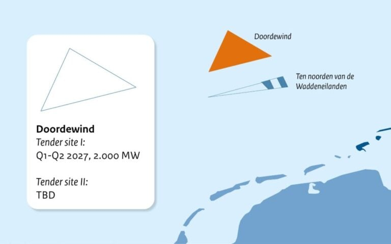
- Doordewind covers approximately 580km² and is planned to accommodate 4GW.
The Netherlands Enterprise Agency, or RVO, has opened a tender for a benthic survey of the Doordewind offshore wind zone in the Dutch North Sea.
Survey teams will collect physical seabed data to verify findings from an earlier desktop reef detection study and establish a baseline description of benthic habitats across the development area.
The Dutch Ministry of Economic Affairs has commissioned the work as part of the site data programme prepared for future offshore wind tenders. The resulting information will support environmental assessment, engineering development, consenting, and bid preparation.
With an estimated value of €700,000 excluding VAT, the contract is scheduled to begin on 10 December 2026 and continue until 31 December 2027. An extension to 1 May 2028 may be used if unforeseen external circumstances delay completion, while tender submissions are due by 1 October 2026.
Doordewind lies approximately 77km north of the Dutch coast and will be the first offshore wind zone planned to connect into the Eemshaven area. Covering roughly 580km², the zone is expected to contain two sites rated at 2GW each.
The combined 4GW forms part of the Dutch offshore wind roadmap, which currently targets 23GW of installed capacity.
Benthic surveys examine organisms and habitats associated with the seabed, using methods that can include sampling, imagery, video transects, sediment analysis, habitat classification, and verification of structures capable of supporting reef communities.
The final survey method will need to reflect water depth, seabed conditions, weather, ecological sensitivity, vessel capability, and the standard of evidence required by the contracting authority.
Early site data shapes engineering decisions
Government led survey programmes reduce the volume of investigation that individual offshore wind bidders must commission independently. Providing a common dataset also allows competing developers to base designs and financial models on broadly consistent information.
Environmental data influences more than consent documentation because habitat locations can affect turbine layouts, cable corridors, anchor plans, scour protection design, vessel access, and the timing of construction activity.
Potential reefs require particular attention where they support protected species or habitats that cannot be treated as uniform sediment. Desktop interpretation can identify likely areas, although physical verification is needed before boundaries and mitigation measures can be defined confidently.
Survey resolution must be sufficient for the decisions it is intended to support. A broad ecological baseline can describe the development area, while detailed micrositing requires more precise information around individual foundations, cable routes, or sensitive features.
The results will need to be combined with geophysical, geotechnical, metocean, archaeological, and unexploded ordnance datasets. Each discipline addresses a separate project risk, but the final turbine and cable design depends on the information being spatially aligned.
A preferred foundation position may have suitable soil conditions yet conflict with a sensitive habitat, archaeological feature, or cable routing constraint. Moving that position can then alter array cable length, wake effects, installation sequence, and foundation loading.
Early public data helps expose those conflicts before developers commit to detailed design, while turbine, foundation, cable, and installation contractors can also assess likely scope when preparing bids.
The Doordewind programme sits within a growing Dutch project pipeline that includes 69 monopiles and associated steelwork planned for the first 1GW phase of Zeevonk.
Projects rated at 2GW require close coordination with transmission infrastructure. Offshore substations, export cables, landfalls, and the Eemshaven connection must develop alongside the generating assets, each with separate survey, design, and consent requirements.
The overall 4GW scale also increases the importance of cumulative environmental assessment. Effects from foundations, cable corridors, noise, vessel movements, and habitat disturbance must be considered across both sites and alongside neighbouring marine activities.
Construction timing can provide one form of mitigation, with seasonal restrictions protecting breeding, migration, or spawning periods. Those restrictions also narrow installation windows and increase competition for vessels.
Design measures may include adjusted foundation positions, cable burial, route changes, adapted scour protection, reduced seabed disturbance, or habitat enhancement, provided each intervention remains compatible with structural, electrical, and maintenance requirements.
Baseline information remains relevant after commissioning because it allows operators and regulators to compare later conditions against the preconstruction environment and assess whether predicted effects occurred.
The tender begins a data collection programme well before turbines are ordered or foundations installed. Its value will lie in converting uncertain seabed features into information that can be priced, designed, consented, and monitored throughout Doordewind’s development.